Space-Air-Ground-Cloud Precision Agriculture
AIRES Technology's Space-Air-Ground-Cloud (SAGC) integrated agriculture solution combines satellite multispectral imagery, UAV hyperspectral payloads, and AI analytics to deliver crop health monitoring, yield estimation, and arable land management — delivering 40% cost savings and 170% efficiency improvement versus conventional approaches.
Optical, multispectral, SAR, and IoT satellite data provides wide-area crop monitoring at plot-level resolution — covering growth stages, vegetation indices, and land-use change across entire agricultural districts continuously.
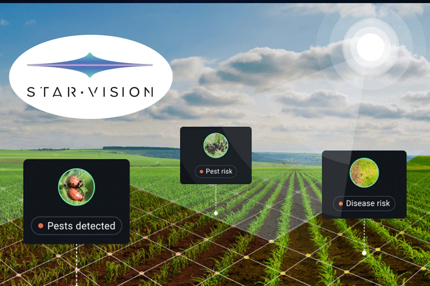
UAV-mounted hyperspectral payloads (400–1,000 nm, 1,200 spectral bands) provide detailed field-level surveys for crop health diagnosis, pest/disease detection, and precision verification of satellite-identified anomalies.
Time-Gated Convolutional Neural Networks (TGCNN) process multi-temporal satellite data to classify crop types, monitor growth stages, and generate yield estimates — providing full-season forecasts updated as imagery comes in.
Automatic change detection identifies illegal occupation, land conversion, and encroachment at the plot level — generating compliance reports for agricultural land protection authorities.
Results are delivered via RESTful API, online preview portal, or as standard geospatial file formats — as monthly, quarterly, or annual thematic reports. Configurable from 5 RS indicators to 10+ RS indicators per report.
The StarDust multi-modal big data processing platform and SkyView geo-spatial analysis platform underpin all analytics — providing scalable processing from field-level surveys to national-scale monitoring programmes.
District-level crop production monitoring for agriculture ministries
Commodity company supply chain crop tracking (palm oil, rubber, rice)
Insurance company crop loss assessment and yield verification
Precision agriculture consultancy for large plantation operators
Arable land protection compliance monitoring
National food security early warning systems
AIRES Technology's Remote Sensing Agriculture Solution integrates four monitoring layers into a unified data and analytics system — satellite, air (UAV), ground sensors, and cloud analytics — delivering the full picture of agricultural production that no single technology layer can provide alone.
The Space-Air-Ground-Cloud (SAGC) architecture produces a documented 40% cost saving and 170% efficiency improvement over conventional crop monitoring approaches, while providing full-process monitoring coverage across the complete growing season.
Multiple satellite types work in combination:
| Satellite Type | Capability |
|---|---|
| Optical satellites | High-resolution visible imagery |
| Multispectral satellites | Vegetation index mapping, crop health |
| SAR satellites | All-weather, all-day penetration through cloud |
| IoT satellites | Ground sensor data uplink from remote fields |
Coverage frequency: 1 time per 2–4 days for most monitoring applications.
UAV platforms carrying multispectral and hyperspectral payloads provide:
Ground-based sensors and cameras provide:
Continuous monitoring of:
AI-powered classification identifies:
Multi-temporal analysis of vegetation indices combined with historical yield data delivers:
Automatic change detection identifies:
| Product | Frequency | Content |
|---|---|---|
| 5 RS Indicators Report | Monthly/Quarterly | 5 key remote sensing indices for the coverage area |
| 10 RS Indicators Report | Monthly/Quarterly | Expanded 10-index thematic analysis |
| Change Detection Report | Event-triggered | Land use change with mapped extents |
| Crop Classification Map | Seasonal | Classified crop type map at plot level |
| Yield Estimate Report | Seasonal | Crop production forecast with confidence range |
Delivery via: RESTful API (JSON/GeoJSON), online preview portal, or standard GIS formats.
The complete SAGC system comprises:
| Metric | Value |
|---|---|
| Cost saving vs. conventional | 40% |
| Efficiency improvement | 170% |
| Added value from SAGC vs. single-layer | 50% |
| Monitoring coverage | Full-process, full-season |
| Spatial resolution | Plot-level |
| Temporal frequency | 1× per 2–4 days (satellite) |
Get in touch with our team for a product demo, pricing information, or to discuss how Remote Sensing Agriculture Solution can be deployed in your organisation.