1,200-Band Aerial Spectral Imaging
The Ramoton FS Series hyperspectral camera mounts on DJI M300/M350 drones to deliver 1,200 continuous spectral bands (400–1,000 nm) at 2.5 nm resolution and 128 Hz imaging speed. Used for precision agriculture, water quality monitoring, forest health, and environmental survey applications.
The Ramoton FS uses a transmission grating spectrometer module with chromatic aberration-corrected optics and high-diffraction efficiency — delivering >60% spectral efficiency with <0.5% stray light across the full 400–1,000 nm range.
1,200 continuous spectral channels from 400–1,000 nm at 2.5 nm resolution — providing far more spectral granularity than standard multispectral sensors (typically 5–10 bands) for detailed material identification and health analysis.
The CMOS detector delivers 128 Hz imaging across the full spectrum (up to 3,300 Hz at ROI), with 1,920 spatial pixels and 5.86 µm pixel size — enabling high ground speed operations without motion blur.
Region-based reflectance calibration with a 25mm calibration panel, real-time radiance measurement, and batch processing capability — delivering calibrated, science-grade spectral data rather than raw sensor output.
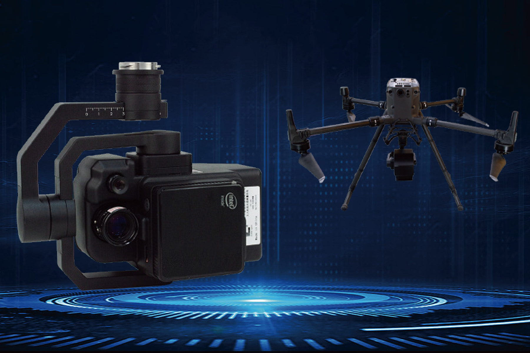
Designed as an integrated gimbal payload for DJI Matrice 300/350 RTK — compatible with DJI's drone management ecosystem, GPS navigation, and onboard RTK positioning for spatially accurate data collection.
Internal processing chip, 8GB RAM, and 1TB SSD handle data acquisition and on-board processing — with USB camera output and Windows-compatible software for post-flight analysis.
Crop stress, disease, and nutrient deficiency detection
Precision agriculture variable rate prescription mapping
Forest health monitoring and pine wilt nematode detection
Water quality parameter monitoring (turbidity, COD, nitrogen, phosphorus)
Coastal and marine environmental survey
Poppy and illicit crop detection for law enforcement
The Ramoton FS Series is a compact, integrated hyperspectral imaging payload designed specifically for DJI Matrice 300/350 RTK drones. It delivers research-grade spectral data — 1,200 continuous bands from 400–1,000 nm — in a 1,185 g package that any M300/M350 operator can deploy without specialist setup.
Where standard multispectral sensors provide 5–10 discrete wavelength bands for vegetation index calculation, the Ramoton FS provides 1,200 continuous spectral channels — enabling detailed identification of plant health indicators, water chemistry parameters, and material composition that band-limited sensors cannot distinguish.
| Parameter | Value |
|---|---|
| Spectral Mode | Transmission grating spectroscopy |
| Spectral Range | 400–1,000 nm |
| Spectral Bands | 1,200 continuous channels |
| Spectral Resolution | 2.5 nm |
| Spectral Efficiency | >60% |
| Stray Light | <0.5% |
| Slit Width | ≤25 µm |
| Parameter | Value |
|---|---|
| Spatial Pixels | 1,920 |
| Pixel Size | 5.86 µm |
| Field of View | >25° |
| Lens Focal Length | 25 mm |
| Imaging Speed (full spectrum) | 128 Hz |
| Imaging Speed (ROI max) | 3,300 Hz |
| Detector | CMOS |
| Signal-to-Noise Ratio (peak) | 600:1 |
| Camera Interface | USB |
| Lens Interface | C-Mount |
| Parameter | Value |
|---|---|
| Dimensions (L×W×H) | 206 × 129 × 119 mm |
| Weight | ≤1,185 g |
| Internal Computing | Built-in chip |
| RAM | 8GB |
| Storage | 1TB SSD |
| Cooling | Internal air cooling |
| OS Compatibility | Windows |
The complete airborne hyperspectral system integrates:
Crop stress detection:
Variable rate prescription mapping:
Pine wilt nematode detection:
The Ramoton FS has validated performance for:
| Parameter | Detection Capability |
|---|---|
| Turbidity | Spectral reflectance in visible bands |
| Suspended solids | Scattering coefficient indices |
| Chemical oxygen demand (COD) | Correlation with spectral proxies |
| Ammonia nitrogen (NH₄-N) | Absorption feature identification |
| Total nitrogen | Composite index calculation |
| Total phosphorus | Multi-band spectral model |
Coastal/marine environment:
Law enforcement:
Get in touch with our team for a product demo, pricing information, or to discuss how Hyperspectral Camera for DJI M300/M350 can be deployed in your organisation.